
Rebun, Hokkaido
You can help expand this article with text translated from the corresponding article in Japanese. (June 2022) Click [show] for important translation instructions.
|
Rebun
礼文町 | |
|---|---|
Town | |
 Kafuka Port in Rebun | |
 Flag  Seal | |
 Location of Rebun in Hokkaido | |
 Rebun Location in Japan | |
| Coordinates: 45°18′N 141°3′E / 45.300°N 141.050°E | |
| Country | Japan |
| Region | Hokkaido |
| Prefecture | Hokkaido |
| District | Rebun District |
| Area | |
• Total | 81.33 km2 (31.40 sq mi) |
| Population (September 30, 2016) | |
• Total | 2,651 |
| • Density | 33/km2 (84/sq mi) |
| Time zone | UTC+09:00 (JST) |
| City hall address | 558-5 Aza Tonnai, Ōaza Kafuka-mura, Hokkaidō 097-1201 |
| Climate | Dfb |
| Website | www |
| Symbols | |
| Bird | Japanese robin |
| Flower | Leontopodium discolor (ezo-usuyuki-sō) |
| Tree | Juniperus chinensis |
Rebun (礼文町, Rebun-chō) is a town located in Sōya Subprefecture, Hokkaido, Japan. The district and town both cover the island of the same name: Rebun Island. Rebun Island is famous for its alpine flowers.
History
[edit]Pre-Dynastical and Prehistorical Period
[edit]Various prehistoric ruins from the Okhotsk culture have been discovered in the areas of Kafukai and Funadomari. Later down the line it seems that there was also the presence of various Ainu , leading to the various remains of castles from the Ainu period, scattered across the area.
Kosho Period
[edit]In 1456 ( Kōshō 2): A battle between the Kafukai Ainu and the Isogai Ainu took place near present-day Momoiwa, right next to today's town.
Jokyo Period
[edit]In 1685 ( Jokyo 2): The area became a soya place directly controlled by the Matsumae Domain, and both the settlements in Rishiri and Rebun became their subsidiary places.[1]
Meiwa Period
[edit]In 1765 ( Meiwa 2), Rebun, Rishiri, and Soya were declared independent provinces.[1]
Bunsei Period
[edit]In the later part of the Edo Period, in 1819 ( Bunsei 2), Ihei Fujino becomes the contractor for the Soya place of the Matsumae domain, developing it.[1]
Koka Period
[edit]1846 ( Koka 3): Mannosuke Yanagida, who moved from the Aomori Prefecture, becomes the first immigrant to Shakunin and begins developing fishing grounds, opening the Oshima fishing grounds in Shakunin (Kafuku/Rebun). Up until now the population was mostly Ainu.[1]
Meiji Period
[edit]During the Meiji era, the city strenghtened its administrative core, as in 1878 ( Meiji 11) The village head offices of Rebun County were established in Kafuka. However, in 1892 (Meiji 25), the village of Funadomari was separated, shrinking its size.[2]
This was part of a larger campaign in the Meiji Era to modernize local administrations, thus part of the famous Meiji Restoration.
Showa Period
[edit]Whilst politically, through the establishment of a modern local administration in the area, the Meiji restoration had already reached the town, only by the Showa Period would the construction of a power distribution line be completed in Uchiji village, and only then would the electricity is now distributed to all villages in the Kafuka district, including Rebun.[1]
On September 20, 1956 ( Showa 31), due to the deterioration of the financial situation of Kafuka Village, the villages of Funadomari and Kafuka merge (to form a new village) known as Rebun Village, once again enlarging Rebun's administrative area. This was officialized in 1959 (Showa 34), as the town was incorporated as Rebun Town.[3]
Geography
[edit]The town covers the entire area of Rebun Island in the Sea of Japan. Rebun is located approximately 50 kilometres (31 mi) from Wakkanai on mainland Hokkaido and 10 kilometres (6.2 mi) northwest of Rishiri Island. The entire island is part of the Rishiri-Rebun-Sarobetsu National Park. Lake Kushu and Mount Rebun (Rebun's highest point) are located in the town.
Rebun is well known for its 300 species of alpine flowers, some of which are endemic to the island. For this it has earned the moniker the island of flowers.[4] Such flowers include: Cypripedium macranthum Sw. var. rebunense (Kudo) Miyabe et Kudo (Rebun atsumori-sō).
Climate
[edit]| Climate data for Rebun, 2003–2020 normals, extremes 2004–present | |||||||||||||
|---|---|---|---|---|---|---|---|---|---|---|---|---|---|
| Month | Jan | Feb | Mar | Apr | May | Jun | Jul | Aug | Sep | Oct | Nov | Dec | Year |
| Record high °C (°F) | 6.9 (44.4) |
6.7 (44.1) |
11.0 (51.8) |
17.4 (63.3) |
20.8 (69.4) |
24.6 (76.3) |
29.9 (85.8) |
30.5 (86.9) |
29.0 (84.2) |
22.3 (72.1) |
15.5 (59.9) |
10.9 (51.6) |
30.5 (86.9) |
| Mean daily maximum °C (°F) | −2.7 (27.1) |
−2.1 (28.2) |
1.7 (35.1) |
6.6 (43.9) |
11.6 (52.9) |
15.9 (60.6) |
20.4 (68.7) |
22.6 (72.7) |
20.5 (68.9) |
13.9 (57.0) |
6.1 (43.0) |
−0.3 (31.5) |
9.5 (49.1) |
| Daily mean °C (°F) | −4.6 (23.7) |
−4.3 (24.3) |
−0.4 (31.3) |
4.1 (39.4) |
8.5 (47.3) |
12.8 (55.0) |
17.3 (63.1) |
19.7 (67.5) |
17.4 (63.3) |
11.2 (52.2) |
3.6 (38.5) |
−2.4 (27.7) |
6.9 (44.4) |
| Mean daily minimum °C (°F) | −6.5 (20.3) |
−6.4 (20.5) |
−2.4 (27.7) |
1.8 (35.2) |
6.0 (42.8) |
10.3 (50.5) |
14.9 (58.8) |
17.3 (63.1) |
14.5 (58.1) |
8.4 (47.1) |
1.2 (34.2) |
−4.5 (23.9) |
4.6 (40.2) |
| Record low °C (°F) | −15.8 (3.6) |
−17.1 (1.2) |
−9.6 (14.7) |
−5.7 (21.7) |
0.2 (32.4) |
4.0 (39.2) |
8.1 (46.6) |
10.9 (51.6) |
5.8 (42.4) |
−1.1 (30.0) |
−11.4 (11.5) |
−13.4 (7.9) |
−17.1 (1.2) |
| Average precipitation mm (inches) | 73.4 (2.89) |
51.6 (2.03) |
44.1 (1.74) |
49.2 (1.94) |
79.7 (3.14) |
84.6 (3.33) |
101.0 (3.98) |
138.6 (5.46) |
131.1 (5.16) |
100.4 (3.95) |
98.4 (3.87) |
91.5 (3.60) |
1,043.6 (41.09) |
| Average precipitation days (≥ 1.0 mm) | 17.9 | 14.4 | 10.9 | 8.7 | 9.7 | 9.6 | 7.5 | 8.9 | 10.5 | 11.6 | 12.9 | 16.2 | 138.8 |
| Mean monthly sunshine hours | 47.5 | 72.2 | 153.8 | 192.7 | 170.4 | 125.9 | 126.5 | 154.2 | 186.7 | 159.6 | 82.0 | 42.5 | 1,514.3 |
| Source 1: JMA[5] | |||||||||||||
| Source 2: JMA[6] | |||||||||||||
Demographics
[edit]Per Japanese census data,[7] the population of Rebun has declined in recent decades.
| Year | Pop. | ±% |
|---|---|---|
| 2000 | 3,856 | — |
| 2010 | 3,078 | −20.2% |
| 2020 | 2,509 | −18.5% |
Arts and culture
[edit]Rebun hosts a flower festival every year.[8]
Mascot
[edit]
Rebun's mascot is Atsumon (あつもん), who is a Rebun lady's slipper orchid (a type of the large-flowered cypripedium orchid species). As a flower, its gender is unknown, but its feelings are gentle and calm. It is known to like nature. Its heart (its charm point) is actually the seed of happiness from fourteen different native flowers. However, it will not tolerate anyone harming nature (especially seedlings). If damage is done to nature, its heart will stop beating. It was unveiled in September 2012.[9]
Airspace violations
[edit]With its location in the far north of Japan, Rebun has been the site of the most violations of Japanese airspace. From 1967 to 2017 14 of the 39 violations of Japanese airspace have been near Rebun. This is the most of any location in Japan. They were all by either Soviet aircraft during the Cold War or by Russian aircraft after 1991.
Sister cities
[edit]- Ohasama, Iwate (Currently Hanamaki)
- Yutaka, Hiroshima (Currently Kure)
Gallery
[edit]-
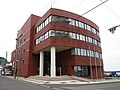 Rebun town hall
 -
 Elementary school in Rebun
 -
 Cape Sukai
 -
 Kafuka Port


References
[edit]- ^ a b c d e https://www.town.rebun.hokkaido.jp/hotnews/files/00002500/00002556/009.pdf
- ^ 礼文島観光協会. "礼文町誕生60周年記念事業|礼文島観光協会". 礼文島観光協会 (in Japanese). Archived from the original on 2016-08-20. Retrieved 2025-05-04.
- ^ 礼文島観光協会. "礼文町誕生60周年記念事業|礼文島観光協会". 礼文島観光協会 (in Japanese). Archived from the original on 2016-08-20. Retrieved 2025-05-04.
- ^ Hunt, Paul (1988). "Rishiri-san". Hiking in Japan: An Adventurer's Guide to the Mountain Trails (First ed.). Tokyo: Kodansha International Ltd. pp. 191–192. ISBN 0-87011-893-5.
- ^ 観測史上1~10位の値(年間を通じての値). JMA. Retrieved February 16, 2022.
- ^ 気象庁 / 平年値(年・月ごとの値). JMA. Retrieved February 16, 2022.
- ^ Rebun population statistics
- ^ Bisignani, J. D. (December 1993). "Dohoku-Northern Hokkaido". In Taran March (ed.). Japan Handbook (Second ed.). Chico, CA USA: Moon Publications, Inc. pp. 836–841. ISBN 0-918373-70-0.
- ^ "りしりんプロフィール". Rishiri.
External links
[edit] Media related to Rebun, Hokkaidō at Wikimedia Commons
 Rishiri-Rebun-Sarobetsu National Park travel guide from Wikivoyage
- Official Website (in Japanese)
| ||||||||||||
| ||||||||||||
| ||||||||||||
| ||||||||||||
| ||||||||||||
| ||||||||||||
| ||||||||||||
| ||||||||||||
| ||||||||||||
| ||||||||||||
| ||||||||||||
| ||||||||||||
| ||||||||||||
| ||||||||||||
| International | |
|---|---|
| National | |
This Hokkaidō location article is a stub. You can help Wikipedia by expanding it. |